After the success of the Israel Trail and the Kinneret Trail, two Israelis have championed the Israel Sea Trail along the coastline. They soon found out the track is impossible
Moshe Gilad Apr. 17, 2022

Moshe Gilad Apr. 17, 2022
It’s a marvel that it took so long to come up with the Israel Sea Trail. It’s obvious, logical and ostensibly arose spontaneously. But when you think about it, the Sea Trail illustrates many of the problems that face hikers, nature lovers, and anyone living in Israel.
The simplest of ideas – a single hiking trail stretching 240 kilometers from Rosh Hanikra in the north to Zikim Beach in the south – is slowly but surely growing into an enormous quagmire. One can remain optimistic, but it will require cosmic patience. It’s unclear whether we will be able to walk the entire trail in our lifetime, but at least we can understand the obstacles.
The first section of the trail was dedicated in February. The optimists believe that another section will be dedicated this summer. When will the trail be complete? Even the astrologers and fortune tellers refuse to commit to a date.

Presumably it’s impossible to get lost along the Sea Trail – if you’re walking south, just make sure the sea stays nearby and on the right. But in effect, after spending a morning with the trail blazers themselves, who have already devoted several years to its development, it appears that one can get lost in countless ways along this simple trail. .
The Sea Trail is a trek through the Israeli jungle. It disappears and twists through the jaws of real estate sharks; it drowns in the sea and rises in the chimneys of the power stations; it is blocked by fighters in the Shayetet naval commando unit; it is vanishes under the wings of energy companies, schools, natural gas drilling, local authorities and anyone who has managed to get their hands on a good chunk of Israel’s coastline.

The trail began optimistically, with a morning coffee at Rosh Hanikra. Dr. Ellik Adler, former head of the Marine and Coastal Environment Division in the Environmental Protection Ministry, who now works for the United Nations Environment Program, and Prof. Noga Collins-Kreiner of the Department of Geography and Environmental Studies at the University of Haifa, are the initiative’s proud parents. From the lovely outlook at Israel’s northernmost point, the path wends southward among blooming fields opposite the sea. It looks dreamy.
The good news is that the northern section of the trail is already marked, has plenty of signs and exists in the real world. The recently inaugurated section leads from Rosh Hanikra for six kilometers (about 3.7 miles) to Akhziv. There, the trail ends and continues south of Nahariya. The Nahariya promenade is expected to one day extend from the south of the city to Moshav Shavei Zion, where the trail will continue to northern Acre. That amounts to a total of 14 kilometers, less than a tenth of the whole.
The length of the coastline down to Zikim is 196 kilometers. The necessary detours add another 45 kilometers. That’s about two weeks of stubborn walking at a steady pace. The trail is built upon existing foundations – trails, urban promenades, coastal paths and treks over the sand. The goal – keep as close to the water as possible. The plan is to divide the trail into sections of about 10 kilometers each.
Adler and Collins-Kreiner believe their mission is possible and even essential. They have enormous faith and speak eloquently about the local economy, how coastal communities will profit from hikers, and community activities along the trail. They even propose a Mediterranean Peace Trail that will include the coasts of Lebanon and Egypt; soon it will take us all the way to a small cafe in southern Italy with excellent espresso. The airlines will be left behind in the dust.

Collins-Kreiner highlights that the trail has a message – beaches belong to the public. She says that the process of marking the trail will lead to environmental battles and will limit the power of real estate sharks that are seizing swaths of the coast. In Israel, these sharks include government ministries, the army, and the Israel Electric Corporation.
The trail’s supporters, with the University of Haifa chief among them, see the importance of social action, local pride and sustainable environmental development. Collins-Kreiner teaches a course in which students deal with the economic, tourism-related and environmental benefits of the Sea Trail. The founders are well aware that the university cannot maintain a hiking trail. Ultimately, Adler explains, they hope to find an organization that can maintain and develop the trail. Candidates include the Nature and Parks Authority, the Tourism Ministry, or the local authorities whose jurisdictions the trail will pass through.
Adler is also familiar with other unsuccessful attempts at building new trails in recent years. Unlike the Israel Trail, which is considered a great success, or the Jesus Trail and the Kinneret trail, whose necessity is undisputed, there are many other marked trails whose justification is in doubt. There is no shortage of examples – The Sanhedrin Trail marked by the Antiquities Authority, the Golani Trail marked by brigade veterans, or trails such as the Emek Hefer Trail or the Path of Light Trail near Ashkelon, which were marked by local governments. Few people, if any, hike those trails and maintaining them is problematic. The Sea Trail is different though, the founders claim.
Adler explains the necessary conditions for a long hiking trail’s success: Its message, its justification, and having a large organization take responsibility for it. In addition to environmental concerns, Adler links the trail’s future to the legacy of the Ha’apala, the illegal immigration of the 1930s and 1940s.
Collins-Kreiner says that the trail will enable us to learn about the entire length of the shore. We’re all familiar with it in terms of width – in other words, we come from the interior and cross the beaches to the waves. But the Sea Trail will allow us to hike long sections of the seafront.

Funding the project isn’t easy. To date, the planners have relied on donations and various foundations that have come to their assistance, as well as help from the University of Haifa. In the future, they hope that large, wealthy organizations like the Israel Land Authority, the Israel Open Spaces Fund, the Tourism Ministry and the Nature and Parks Authority, will volunteer to help.
The two have no doubt that the initiative will succeed – people like to walk along the beach, they explain, and the new trail can provide them with context and a goal.
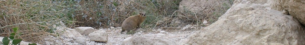
We proceed south along the trail from Rosh Hanikra. A large rock that looks like an ancient anchor marks the first section. The plan is to place 40 such rocks along the length of the trail. At the moment there are only two – at Rosh Hanikra and Atlit. Along the first section, leading up to Betzet Beach, there are several signs describing the project and important topographical, botanical and historical topics. For example, a detailed sign explains the route of the railway that brought travelers to Beirut via the nearby tunnel.

One problem that arises is what Adler rightly describes as “sign pollution” – innumerable signs compete for hikers’ and visitors’ attention. Warnings about drowning, advertisement and rules for proper conduct crowd the coastline. With their differing designs, the overall impression is chaotic and overwhelming.
Currently, the trail markings are white-blue-white. The founders wanted to make the markers blue-white-green, to differentiate it from other trails (and to liken it to the Israel Trail, which also has three colors), but the Israel Trails Committee, headed by members of the Society for the Protection of Nature in Israel, has not approved it.
The SPNI said, “The Sea Trail initiative has sparked a discussion regarding the importance of the trail and its significance for raising awareness of the need to preserve the sea and beaches, and, on the other hand, doubt as to whether the route of the trail is of enough interest to ‘maintain’ a consecutive longitudinal trail. This issue was discussed in the committee for trail marking, and it was decided, at this stage, that the pilot in the Hof Hacarmel region and the Mateh Asher Regional Council would be advanced.”

Many other problems arise as you move southward. A long fence blocks hikers at the entrance to the Akhziv National Park, which is run by the Nature and Parks Authority. There is an entrance fee for the park. The question of whether hikers of the Sea Trail will be allowed free access to the beach is an excellent example of the more serious problems that will crop up later on the trail.
At the inauguration ceremony for the northern section of the trail, Raya Shurki, acting deputy of the authority, announced that hikers would receive free passage in Akhziv. That is also relevant to Caesarea, Palmachim and Ashkelon, which are also paid sites run by the Nature and Parks Authority.
We bypass the rusty fence and look at the Akhziv Beach. Poems have been written about it. You can’t help but fall in love with the beautiful circular bay.
From Akhziv to Nahariya the trail is still unmarked and it picks up again from Shavei Zion to Acre. Adler describes Haifa Bay as a “huge obstacle,” and it’s easy to understand why – his first example is the Israeli Naval Academy in Acre. Although the institution is run by the Education Ministry, permission hasn’t yet been granted to mark the trail and enable the passage of hikers. The Mevo’ot Yam youth village in Mikmoret is a similar case.
According to Adler, “it’s illogical. The trail is a first-class educational initiative and they’re blocking us.” The Acre municipality actually supports the trail, but the temporary solution is a “detour,” Adler says. “We’ll build the trail and the public will wage war against the pockets of resistance.”

Next, the trail butts up against the Haifa Bay industrial area, Rafael Advanced Defense Systems, the Kishon Port, the Haifa Port and a slew of endless obstacles. “We’ll set aside the bay for two years,” says Adler. “We’ll return to the trail from Bat Galim southward. The message is very important to us – it’s not just a beautiful and romantic trail. Look and see the problems, the energy economy, the gas rig opposite Dor Beach.”
The planned informational signs will also mention these issues – the Natural Gas Authority, the development initiatives endangering the coast; for example, the idea of building an airport in the sea opposite Bat Galim.
Continuing southward, another 36 kilometer stretch is supposed to open in July along the coast of the Hof HaCarmel regional council, which borders Haifa on the north and Hadera on the south.
In Atlit there’s a lovely 1,000-year-old fortress on the coast. Nobody visits because it’s used as a base for the Shayetet. The unit commanders (for example, Maj. Gen. [res.] Ami Ayalon), have previously agreed to move the base to another less sensitive site, but nothing has happened.
The trail’s importance lies in placing pressure on centers of power and government. The Israel Defense Forces, the Defense Ministry, the Israel Electric Corporation infrastructure, power stations and desalination facilities all pose additional obstacles. It’s always possible to bypass, detour and complain, but the real significance lies in the struggle itself.
It’s worthwhile not to rush to find a convenient bypass on a more inland route, but rather to point out the obstacles, the ones that have become invisible to us, and to say, let us walk on the beach. It belongs to all of us. Even if the effort fails – drawing attention to it is an achievement.
The trail also holds small gems. Last year, a new 90-meter stone pedestrian bridge over Nahal Taninim, right near the stream’s estuary to the sea, was dedicated in Jisr al-Zarqa. It’s a reconstruction of a bridge that was built by the Turks in honor of the visit of German Kaiser Wilhelm II, nearly 100 years ago. The Turks also built their bridge on the foundation of a much more ancient bridge. The new bridge will blend beautifully with the trail’s path.

Other small treats – from Mikhmoret up to the Yarkon River in Tel Aviv the trail is adjacent to the Israel Trail, which is close to the beach in this section. In Netanya, Herzliya, Tel Aviv and Bat Yam there are also long and well built municipal promenades, which are well maintained by the cities.
Returning to the problems: South of Rishon Letzion is the Shafdan, a wastewater treatment plant. Later on, the trail organizers are planning to return to the beach in the area of the Nahal Sorek estuary near Palmachim and from there to Ashdod. There, of course, they will encounter a large port and a power station. Further south, in the Ashkelon-Zikim area, there is another power station, a port for the oil pipeline and a military base.
South of the Zikim Beach, on the border of the Gaza Strip, a large barrier now invades the sea – the marine barrier whose construction ended last year. It is 200 meters long, 50 meters wide topped by a 6-meter-high fence. When the Mediterranean Peace Trail is marked, they will have to find a solution for that. Then we’ll be able to finally walk to the beautiful Hof Dekalim in El-Arish. It’s only 80 kilometers southwest of Ashkelon.
