The avocado groves to which the revelers massacred at the Re’im party fled and the Be’eri crater near which dozens of hostages were held are a reminder of how beautiful the western Negev is – and how great the hope is that it will return to what it was before it became a scene of mass murder
Moshe Gilad. Oct 12, 2023

The first and clearest image that comes to mind is of green expanses, round hills, scattered trees dotting the landscape and sandy soil. Complete pastoral bliss. My recollections of the place are of the serenity of cotton, wheat and barley fields. But our television screens are currently showing a completely different picture.
Memory is sometimes confusing. The scenes on television are even more so. The landscapes, the highway junctions, the trees and the homes all seem familiar and accessible. There’s the right turn to Zikim. There’s the Yad Mordechai junction and then the Be’eri junction and the turn toward Mefalsim.


But the television coverage is of hundreds of young people attending a rave party near Re’im who were fleeing terrorists. And burned out tanks near Be’eri? The connection between the setting and this week’s developments is incomprehensible, particularly for those who love the open spaces of the western Negev and who think of the area as tailor-made for the perfect hike.
Since Saturday’s invasion of the area by Hamas terrorists from Gaza and the mass killing spree that they carried out in the Israeli communities in the border area, the intensive television coverage of the horrors left me with a remaining, clear sense of how beautiful this area is and how great the pain is over what has happened there.

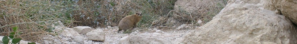
The unconceivable scenes of young people fleeing the outdoor rave party near Kibbutz Re’im at dawn, many trying to save themselves by hiding among the avocado and eucalyptus groves, bring to mind my countless visits there to view the annual blooming of the anemone flowers, for a two-month period, as they spread a vast, glorious carpet over the desert floor.
Each of the hikes in the area passes the bullet-pocked concrete security house of old Be’eri. The bullets were fired in 1948. Everything and nothing has changed since. Kibbutz Be’eri, which takes its name from early Labor Zionist leader Berl Katznelson’s nom de plume, was established in 1946 as one of 11 new Jewish communities in the northern Negev.
Initially the kibbutz founders settled on the site now known as old Be’eri, some 3 kilometers (about 2 miles) to the west of the current kibbutz. At the site, there are two large structures – the security house and a water tower, along with a pleasant picnic area and a monument to the Jews of Baghdad, from which some of Be’eri’s founders came. The need for a concrete security house at Be’eri is tragically more apparent now than ever. Security forces announced on Monday that, at its current location, they had found more than 100 bodies of victims of Saturday’s terrorist massacre at the kibbutz.
Not a eulogy to the region
The use of the name Gaza in referring to the region is horribly inapt, in my opinion, because it’s a reference to a large Palestinian city on the coast, of which no one has particularly pleasant memories. In complete contrast, the western Negev is one of the most beautiful regions in Israel and one of the places that I most love to revisit. And I want to make it clear – this is not a eulogy to this beloved area. I am trying to understand the secret of its charm, with clear hope of revisiting it as soon as possible.
In normal times, the dominant feeling in the area is that there is air to breathe. It’s an area with hills overlooking wide and open expanses. Even though there are dozens of residential communities in the western Negev, the somewhat deceptive feeling is that the space is wide open, with a view to the distant horizon. There aren’t many such areas in Israel.
And then on every visit, the visitor’s gaze is drawn toward the white houses of Beit Hanun, Gaza City and Khan Yunis in the Gaza Strip. You can always see them, from almost everywhere in the area. You can see them from the roof of the Beit Alami (Musa Alami House), at the top of a hill at Kibbutz Zikim, as well as from the white lookout station established near Mefalsim by the Jewish National Fund and the evacuees from Gaza Strip settlements that Israel withdrew from in 2005 as part of its disengagement withdrawal from the entire Strip.
They can be seen very well too from the small balcony at the top of the ANZAC memorial monument near Be’eri. The monument, shaped like the letter A, is a clear reminder that fighting has been going on in the area for hundreds of years. In 1917, during World War I, it was Australian and New Zealand soldiers who were fighting to take the country from the Ottoman Turks. The monument was designed by the architect Yedidia Eisenstadt.


In January, about eight months ago, I wrote this after visiting the ANZAC memorial: “The tower is open, and it’s worth climbing to the top and looking out from there at the green spaces, toward Gaza, and at the wheat fields and anemones surrounding the site. This is uplifting scenery. On several earlier visits, several tanks were parked here, but this week there was no one around.”
The attempt to understand the magic of this place prompts consideration of the uncommon connection in Israel between wide open spaces and sufficient rain. This is particularly striking in the winter, when the red anemones bloom, attracting multitudes to the region. In the western Negev, among dozens of communities, there are huge brown-green rectangles of agricultural land that are intensively cultivated. Among them, mainly along the paths of the Shikma, Sahaf, Gerar, Besor and Kissufim streams, there are uncultivated areas, hedges of prickly pears (sabras) and scattered enormous trees.

Take a hike
Over the years, the spaces around the dozens of communities in the area bordering on the Gaza Strip have provided me and many others endless opportunities for hiking. There’s the Zikim Sands reserve, the Karmia nature reserve, the Shikma stream and reservoir, the fields of Mefalsim, the forest at the Hanun stream and the Be’eri crater. They offer diverse hiking trails, very rich in ancient and modern history. Even a momentary look at the area near Kibbutz Re’im reveals immense riches.
The Gerar stream is reputedly where the biblical patriarch Isaac’s shepherds settled, after his father, Abraham, came to an agreement over a number of wells with Abimelech, the Philistine king of Gerar. Thousands of years later, in 1950, the community of Sharsheret was established in the area, south of the town of Netivot. It was the first immigrant moshav collective farm built in the Negev after the 1948 War of Independence.

It’s a very short walk from the Re’im parking lot, along Route 232, to a well at the Gerar stream. This one was dug in the early 20th century, but one can still sense the life that once surrounded these wells, with the hills all green and the entire area looking like one huge grazing ground, with shepherds gathered around them.
Near the well, the visitor can still see remnants of the two largest water projects in the northern Negev, the Nile channel and the western water channel. The Nile water pipeline, which was 200 kilometers (124 miles) long, was a British initiative to connect the fresh water canal along the Suez Canal to Deir al-Balah in what is now the Gaza Strip. The western channel carried water from wells drilled in what is now the Gaza border area near Gvar’am and Nir Am to Be’eri, Tkuma and Tze’elim. From there it went to Nirim. Water from the network was also provided to Arab peasant farmers, to Bedouin and to British Mandate police stations in the Negev. This all seems so removed from the current reality in the area.
A few weeks ago, I wrote here about a new and beautiful promenade stretching from the Zikim Mediterranean beach to the Shikma stream. This week this beautiful spot has been associated with reports of attempted terrorist infiltrations from the sea, including a gun battle on Wednesday near Kibbutz Zikim.
At the top of the hill on which the kibbutz stands, there’s a building known as Alami House that was renovated in recent years. From its roof, one can see the sea, the Shikma stream and the reservoir adjacent to it, as well as the buildings in the northernmost Gaza Strip neighborhood.

 Named After the Arab Family Who Lived There Until 1947., Credit: Ilan Asayag")
Alami House was built 100 years ago and is still called the Arab house by kibbutz members. It’s named after the family that built it and used it as a summer or vacation home until 1947. The Alami family was one of the five wealthiest and most influential families in Jerusalem in the early 20th century. When the renovated house was opened, a friend who is a kibbutz member told me that the fact that the Alami family’s link to the house is still recognized through its name provides hope for the future.
“I believe that this house will serve as a possible meeting place between Palestinians and Israelis, not only due to its perfect location, halfway between Ashkelon and Gaza, but due to its past and the past of those who built it. The name is a declaration indicating that we’re not hiding from that past. We recognize history and clearly state – this is our place. It belongs to us now, but we remember what was here in the past and respect it,” the friend said.
I certainly hope so. I don’t think there’s a more sober or correct approach to the issue.